The colmap dataset is a simplified simple feature collection with 33 features and 11 fields. This version was obtained from: GDAM using the sf package and later simplified as:
colmapFormat
Simple feature collection with 33 features and 11 fields:
- GID_1
id from original GDAM
- GID_0
id from original GDAM
- COUNTRY
Colombia.
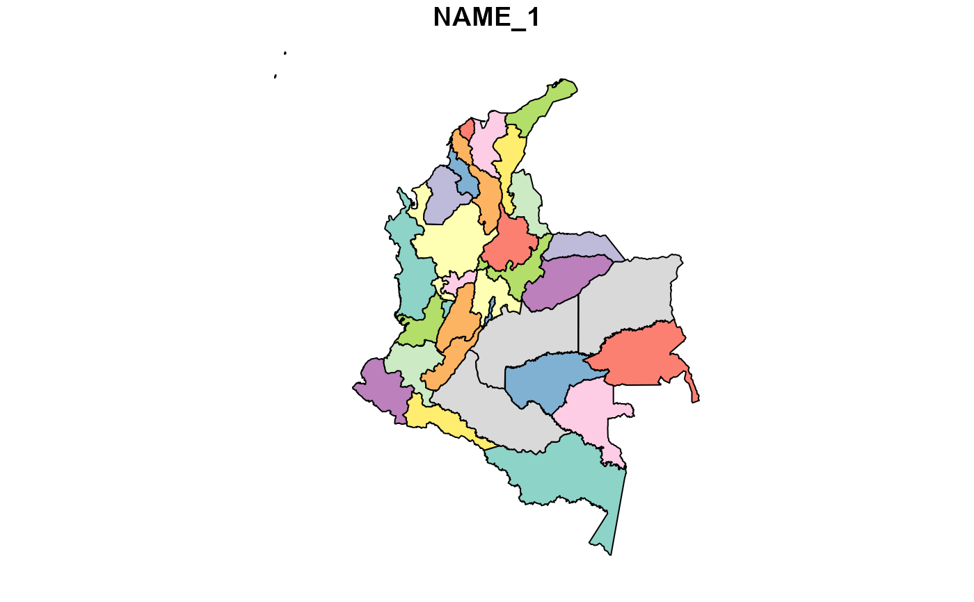
- NAME_1
Departamentos.
- VARNAME_1
class name GDAM.
- NL_NAME_1
order name of GDAM.
- TYPE_1
family name of of GDAM.
- ENGTYPE_1
name of of GDAM.
- CC_1
name of of GDAM
- HASC_1
name of of GDAM
- ISO_1
name of of GDAM
- geometry
polygons of GDAM
Details
colmap <- sf::st_as_sf(gadm(country="COL", level=1, path=tempdir()))
and later apply a polygon simplify using st_simplify with a tolerance of 1km:
colmap <- st_simplify(colmap, preserveTopology = TRUE, dTolerance = 1000)
This dataset is designed to provide users of mammalcol package with a companion map to plot the mammal distribution per departamento.
References
The dataset is based on the "List of the Mammals of Colombia" by Ramírez-Chaves 2021.
See also
For more information about the "mammalcol" package and the data sources, visit the package's GitHub repository: https://github.com/dlizcano/mammalcol
Examples
# Load the mammalcol package
library (mammalcol)
library (sf)
#> Warning: package 'sf' was built under R version 4.4.3
#> Linking to GEOS 3.13.0, GDAL 3.10.1, PROJ 9.5.1; sf_use_s2() is TRUE

# Access the mammalcol_tab dataset
# data ("colmap")

# Display the first few rows
head (colmap)
#> Simple feature collection with 6 features and 11 fields
#> Geometry type: MULTIPOLYGON
#> Dimension:     XY
#> Bounding box:  xmin: -77.1342 ymin: -4.225097 xmax: -69.3931 ymax: 11.06403
#> Geodetic CRS:  WGS 84
#>     GID_1 GID_0  COUNTRY      NAME_1                  VARNAME_1 NL_NAME_1
#> 1 COL.1_2   COL Colombia    Amazonas                       <NA>      <NA>
#> 2 COL.2_2   COL Colombia   Antioquia                       <NA>      <NA>
#> 3 COL.3_2   COL Colombia      Arauca                       <NA>      <NA>
#> 4 COL.4_2   COL Colombia   Atlántico                       <NA>      <NA>
#> 5 COL.5_2   COL Colombia Bogotá D.C. Distrito Capital de Bogotá      <NA>
#> 6 COL.6_2   COL Colombia     Bolívar                       <NA>      <NA>
#>             TYPE_1        ENGTYPE_1 CC_1 HASC_1  ISO_1
#> 1        Comisaría      Commissiary <NA>  CO.AM CO-AMA
#> 2     Departamento       Department <NA>  CO.AN CO-ANT
#> 3      Intendencia       Intendancy <NA>  CO.AR CO-ARA
#> 4     Departamento       Department <NA>  CO.AT   <NA>
#> 5 Distrito Capital Capital District <NA>  CO.DC   <NA>
#> 6     Departamento       Department <NA>  CO.BL   <NA>
#>                         geometry
#> 1 MULTIPOLYGON (((-69.93615 -...
#> 2 MULTIPOLYGON (((-75.59808 5...
#> 3 MULTIPOLYGON (((-69.42688 6...
#> 4 MULTIPOLYGON (((-74.90938 1...
#> 5 MULTIPOLYGON (((-74.24476 4...
#> 6 MULTIPOLYGON (((-75.55547 1...

plot (colmap["NAME_1"])